
| Tramlink | |||||||||||||||||||||||||||||||||
|---|---|---|---|---|---|---|---|---|---|---|---|---|---|---|---|---|---|---|---|---|---|---|---|---|---|---|---|---|---|---|---|---|---|
| Colour on map | Green | ||||||||||||||||||||||||||||||||
| Year opened | 2000 | ||||||||||||||||||||||||||||||||
| Line type | Tramway | ||||||||||||||||||||||||||||||||
| Rolling stock | Bombardier CR-4000 | ||||||||||||||||||||||||||||||||
| Stations served | 39 stops | ||||||||||||||||||||||||||||||||
| Length (km) | 28 | ||||||||||||||||||||||||||||||||
| Length (miles) | 18.5 | ||||||||||||||||||||||||||||||||
| Depots | Therapia Lane | ||||||||||||||||||||||||||||||||
| Journeys made | 24,000,000[1] (per annum) | ||||||||||||||||||||||||||||||||
| Rail lines of Transport for London | |||||||||||||||||||||||||||||||||
| |||||||||||||||||||||||||||||||||
Portal:London Transport London Transport Portal
| |||||||||||||||||||||||||||||||||
Tramlink (initially known as Croydon Tramlink) is a tramway system serving the south London area of England, United Kingdom. The service is currently operated by FirstGroup on behalf of Transport for London (TfL) but it has been agreed that TfL will purchase the system and take control of it later in 2008[2]. Tramlink meets National Rail lines at a number of stations, but because it runs in an area relatively under-served by the London Underground (one of the reasons for its creation), its only interchange with the Underground is at Wimbledon. The system, centred on Croydon, began operation in May 2000.
Tramlink consists of a mixture of street track shared with other vehicles, dedicated track within the street, and off-street track. The off-street track includes new rights-of-way, former railway lines, and one section that shares the right-of-way (though not track) with a third-rail electrified Network Rail line.
History[]
- Main article: Trams in London
Former lines re-used[]
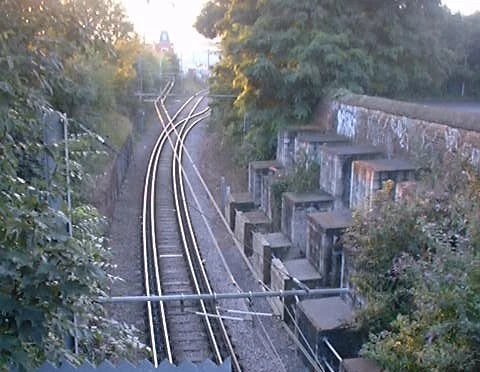
interlaced track near Mitcham
Route 2 runs parallel to the Crystal Palace to Beckenham Junction line of the Southern network between Birkbeck and Beckenham Junction, the National Rail track having been made single track some years earlier.[3]
From Elmers End to Woodside, route 1 (combined with route 2 from Arena) follows the former British Rail branch line towards Addiscombe station, 500 metres west of the tram stop of the same name, which has been demolished and the site redeveloped. At Woodside, the old station buildings still stand but are disused, and the original platforms have been demolished to make way for accessible low platforms.
From Woodside to near Sandilands (routes 1 & 2) and from near Sandilands almost to Lloyd Park (route 3) Tramlink follows the former Woodside and South Croydon Railway, including the Park Hill (or Sandilands) tunnels.
The section of Route 3 between Wimbledon and West Croydon follows the old single-track British Rail route for the most part, which was closed in the mid 1990s so that it could be converted for Tramlink. Within this section, from near Phipps Bridge to near Reeves Corner, route 3 follows the Surrey Iron Railway. This gives Tramlink a claim to be, in a sense, one of the world's oldest tramways. Template:Gbmapscaled beside Mitcham tram stop had its name long before Tramlink. A partial obstruction of the route near this point has necessitated the use of interlaced track.
A Victorian footbridge beside Waddon New Road had to be demolished to make way for the flyover that takes Tramlink over the West Croydon to Sutton railway line. The footbridge has been re-erected at Corfe Castle station on the Swanage Railway.
Current system[]
Network Map[]

Stops[]

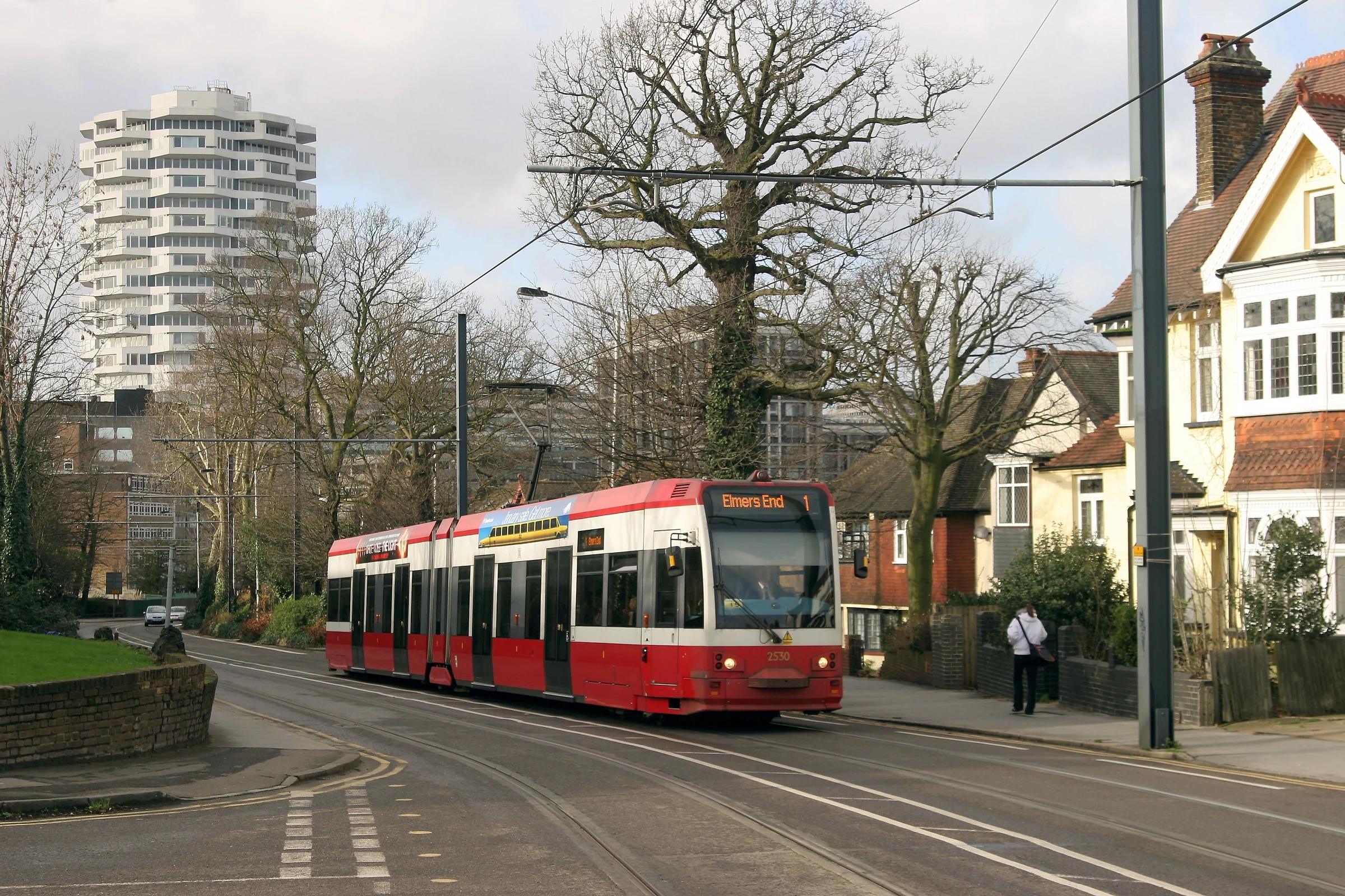
Tram No 2530 leaving Croydon on an Elmers End service
Stops have low platforms 350 mm above rail level. Stops are un-staffed and have automated ticket machines for ticket sales. In general, access between the platforms involves crossing the tracks by pedestrian level crossing. There are 39 tram stops, most being 32.2 m long. They are almost exactly level with the doors and are all wider than 2 m. This allows for wheelchairs, prams, pushchairs and the elderly to board the tram easily with no steps. In street sections, the pavement is integrated with the tram stop.
Tramlink uses some former main-line stations on the Wimbledon - West Croydon and Elmers End - Coombe Road stretches of line that were taken over. The railway platforms have been demolished and rebuilt to Tramlink specifications, except at Elmers End and Wimbledon where the track level was raised to meet the higher platforms, to enable cross-platform interchange.
Thirty eight stops opened as part of the phased introduction of tram services in May 2000. Centrale Stop in Tamworth Road opened on 10 December 2005, increasing journey times slightly. As turnround times are already quite tight this raised the issue of buying an extra tram to maintain punctuality. Partly for this reason, but also to take into account the planned restructuring of services (subsequently introduced in July 2006), Tfl had issued tenders for a new tram. However nothing resulted from this.
All stops have disabled access, raised paving, CCTV, a Passenger Help Point, a Passenger Information Display (PID), litter bins, a ticket machine, a noticeboard and lamp-posts, and most also have seats and a shelter.
The PIDs display the destination and expected arrival times of the next two trams. They can also display any message the controllers want to display, such as information on delays or even direct instructions to vandals to stop placing objects on the track.
Routes[]
Tramlink is not shown on the standard tube map, but is shown on the "London Connections" map. On 23 July 2006 the route network was restructured, with route 1 from Elmers End to Croydon and route 2 from Beckenham Junction to Croydon, running every 10 minutes Monday - Saturday daytime, every 30 minutes at other times, and route 3 from New Addington to Wimbledon every 7.5 minutes Monday - Saturday daytime, every 15 minutes at other times.
The current routes are, from east to west:
Route 1 (yellow)[]
Template:Mainarticle

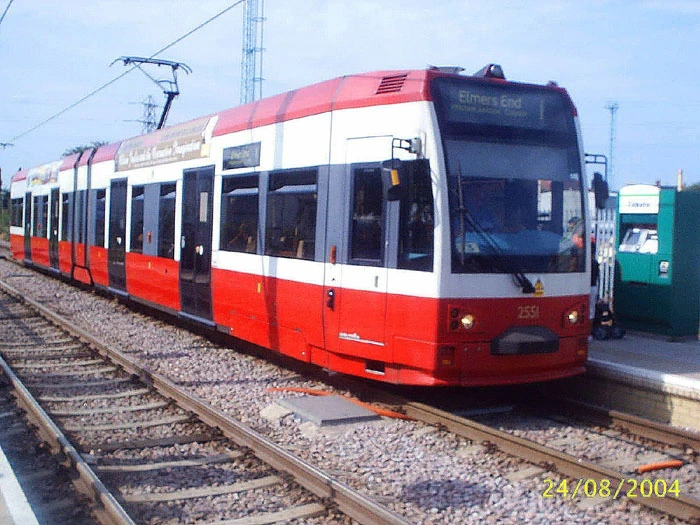
A tram heading for Elmers End on Tramlink route 1.
| Route 1 |
|---|
Then to East Croydon and back to Elmers End |
Route 2 (red)[]
Template:Mainarticle
A tram at the Beckenham Junction terminus
| Route 2 |
|---|
Then to East Croydon and back to Beckenham Junction |
Route 3 (green)[]
Template:Mainarticle

A Tram heading to New Addington on Tramlink Line 3
| Route 3 |
|---|
Then back to Wandle Park
Then to East Croydon and back to New Addington |
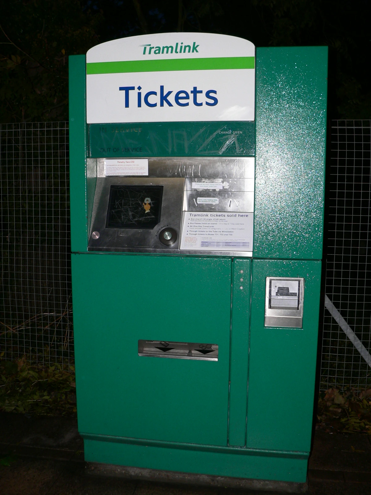

A Tramlink Ticket Machine
Fares and ticketing[]
| Ticket | Cost |
|---|---|
| Cash single | £2.20 |
| Oyster single | 90p |
The adult single cash fare is £2.00. Day return fares used to be sold at double the single fare, but since a one day bus pass is now 50p cheaper than the return fare there is no point buying a return. For this reason return fares have not been offered since the January 2008 fare changes. Special fares may apply when using Tramlink feeder buses. Oyster Cards are valid on Tramlink with both pay-as-you-go and travelcards. The adult single Oyster fare is £0.90 and 16-17 or New Deal Photocard holders pay £0.50. When using Oyster, the passenger must touch in on the platform before boarding the tram. The daily cap for using buses and trams only is £3.00 for adults and £1.50 for 16-17 and New Deal Photocard holders. When starting a journey from Wimbledon, the Oyster card must be touched in at the gates and on the Tramlink platform. Similarly, when leaving Wimbledon, passengers must touch out when leaving the station, but must not use the manual gate.
All Bus Passes (1 Day, 7 Days, Monthly and Annual) are valid on Tramlink. Bus Saver Tickets are not valid. Valid Travelcards that include any of zones 3, 4, 5 and 6 are valid on Tramlink network. Free travel is available for:
- under 14 year olds
- 11-13 year olds using the tram at Wimbledon with an Under-14 or Child Oyster photocard
- 14-15 year olds with a 14-15 or Child Oyster photocard
- 16-17 year olds living in London who are studying full time and have a 16-17 Oyster photocard
- wheelchair users
- Freedom Pass holders
Rolling Stock[]
Tramlink is operated with articulated low-floor Flexity Swift CR-4000 trams built by Bombardier Transportation in Vienna. The fleet is currently 24 strong, with one more planned. The trams are based on the very similar class K-4000 built used on Köln's low-platform routes.
The trams are six-axle single-articulated double-ended cars with four doors on each side. The low floor stretches between both the outer doors through the articulation (which rests on an unpowered bogie/truck). Between the outer door and each car end is a higher-floor section, accessed up a step and situated over the car's two power bogies. The low-floor section is 400 mm above rail-level, sloping down to 350 mm in the doorways, a height that matches the platforms at tram stops, and each car has two wheelchair positions.
The trams are 30.1 m long and 2.65 m wide, with 70 seats and a total capacity of just over 200 passengers. They operate from an overhead power supply at 750 V DC, and have a maximum speed of 80 km/h (50 mph). Each tram has an integral traction braking controller with deadman's handle. While stationary, the tram is immobilised until the driver's hand is on the controller: if the driver's hand is removed from the controller while moving, an alarm sounds immediately and the driver's hand must return to the controller to disarm it. If a three-second countdown passes and it is not disarmed, the track brakes are applied.
The trams are numbered beginning at 2530, continuing from the highest-numbered tram, number 2529 on Croydon's former network, which closed in 1952.

Future Developments[]
Template:Future UK public transportation
| Tramlink | |
| File:Tramlink.jpg | |
| Locale | South London |
|---|---|
| Transit type | Electrified Metro Tramway |
| Began operation | 2000 |
| System length | 28 km |
| No. of lines | 3 |
| No. of stations | 39 |
| Track gauge | standard gauge |
| Operator | FirstGroup/London Trams |
Projected extensions[]
The Mayor's Transport Strategy for London states that extensions to the Tramlink network could be developed at relatively modest cost where there is potential demand from existing and new development to support concentrated passenger movements, and where Tramlink technology might be cost effective. Proposal 4D7 says that "The Mayor will explore the potential for extending the Tramlink network where doing so could help meet the objectives of the Transport Strategy cost effectively" and sought initial views on the viability of a number of extensions by summer 2002.
An initial review of potential Tramlink extensions has been prepared and discussed with interested parties. TfL now wishes to carry out initial development and evaluation work on the following routes:
| Extension | Route | |
|---|---|---|
| Sutton Town Centre/Station - Wimbledon | Through St Helier, Morden and Morden Road (including via St. Helier Hospital and direct routes and routing variants within Sutton Town Centre) | |
| Sutton – Tooting | Through St Helier and Mitcham (including routing variants via Mitcham Junction and direct) | |
| Mitcham Junction – Mitcham town centre | Through Mitcham Common | |
| Central Croydon - Coulsdon | Through Purley/Purley Station and could involve a Park and Ride scheme | |
| Central Croydon - Streatham | Through Thornton Heath and Norbury as well as past Mayday Hospital | |
| Harrington Road/Beckenham Junction – Crystal Palace | Various route options including (below) | |
- from Harrington Road and Birkbeck
- Crystal Palace
- from Church Street and Wellesey Road
- South Croydon
- Purley
- from Reeves Corner and West Croydon
- Thornton Heath Pond
- Norbury
- Streatham (connection with Thameslink)
- from Wimbledon (follows Thameslink to Sutton)
- Wimbledon Chase
- South Merton
- Morden South
- St Helier
- Sutton Common
- West Sutton
- Sutton
- Mitcham (intersection at current stop)
- Tooting (connection with Thameslink)
- Tooting Broadway (connection with Northern line)
Other extension proposals include Lewisham, Bromley town centre, Biggin Hill Airport/Village and a local spur/loop to penetrate further into Purley Way retail/industrial park.
Starting in the west, there are two corridors that suggest bringing Tramlink to Sutton town centre. The first of these, proposing operations principally between Wimbledon and Sutton, has been in view even before Tramlink opened. Indeed, presumptuously, the trams were delivered with destination displays for this as “line 4” already included on blind sets.
Extension D / Route 4[]
| Proposed Route |
|---|
Then back to Penge Road
Then to East Croydon and back to Beckenham Junction or Crystal Palace |
Tramlink route 4, is currently the only extension being developed. The proposed routes link Harrington Road stop with Crystal Palace, and Crystal Palace directly with Beckenham Junction, both terminating at Crystal Palace Parade. There are three options on how to get to the Parade: on-street, off-street and a mixture of the two.[4] Following recent consultation the off-street option is favoured, with trams running along existing railway as far as Crystal Palace Station, and then running round the western edge of Crystal Palace Park (within the current park's perimeter) to the bus terminus near the parade.[5]
Extension A[]
The Sutton to Wimbledon proposal utilises the existing Tramlink infrastructure between Wimbledon and Morden Road stop. The cramped tram terminus inside Wimbledon station is barely adequate for its present function. If another service is to arrive at Wimbledon a new terminus will need to be created. Diverging from the present Croydon route the Sutton line might adopt segregated alignment within the highway along Morden Road, serving Morden station interchange. It would probably use Aberconway Road to reach Morden Hall Road before using the spacious St Helier Avenue as the direct route to St Helier, Rose Hill. St Helier Hospital is an important local traffic objective that Tramlink ought to serve, despite the need to deviate from the direct route into Sutton via Angel Hill. A number of variants in Sutton Town centre are to be examined to see how the shopping centre, station and office complex can be accessed. The alignment is presently served by a number of busy bus services and if built, would give Tramlink patrons direct interchange with the Northern Line at Morden. A south-to-east curve may also be considered at Morden Road to permit direct operations that link St Helier to Mitcham and Croydon. [6]
Extension B[]
The other Sutton proposal – to Tooting - is more ambitious and undoubtedly contains many more challenges than Sutton/Wimbledon link. Apart from workshop/depot facilities and a curve required to link the line into the existing system, this extension would share no infrastructure with the existing Tramlink. Were “line 4” to be realised ahead of this proposal, the Tooting line would of course then have the St Helier to Sutton section in common. North of St Helier, the alignment is likely to fit across parkland and open space to take in the Willow Lane Industrial Estate before serving Mitcham town centre. Some commonality would be enjoyed here with the short separate proposal to provide a spur from Mitcham Junction to Mitcham town centre. From here, the Tooting projection would seek to use the pedestrianised town centre section before sharing carriageway with all traffic in the part of London Road south of Figge’s Marsh, with room for segregation beyond the junction with Streatham Road. The most difficult leg arises immediately the Merton/Wandsworth boundary is crossed and the most effective way of reaching Tooting Broadway from this point will stir much debate.
North and south from Croydon[]
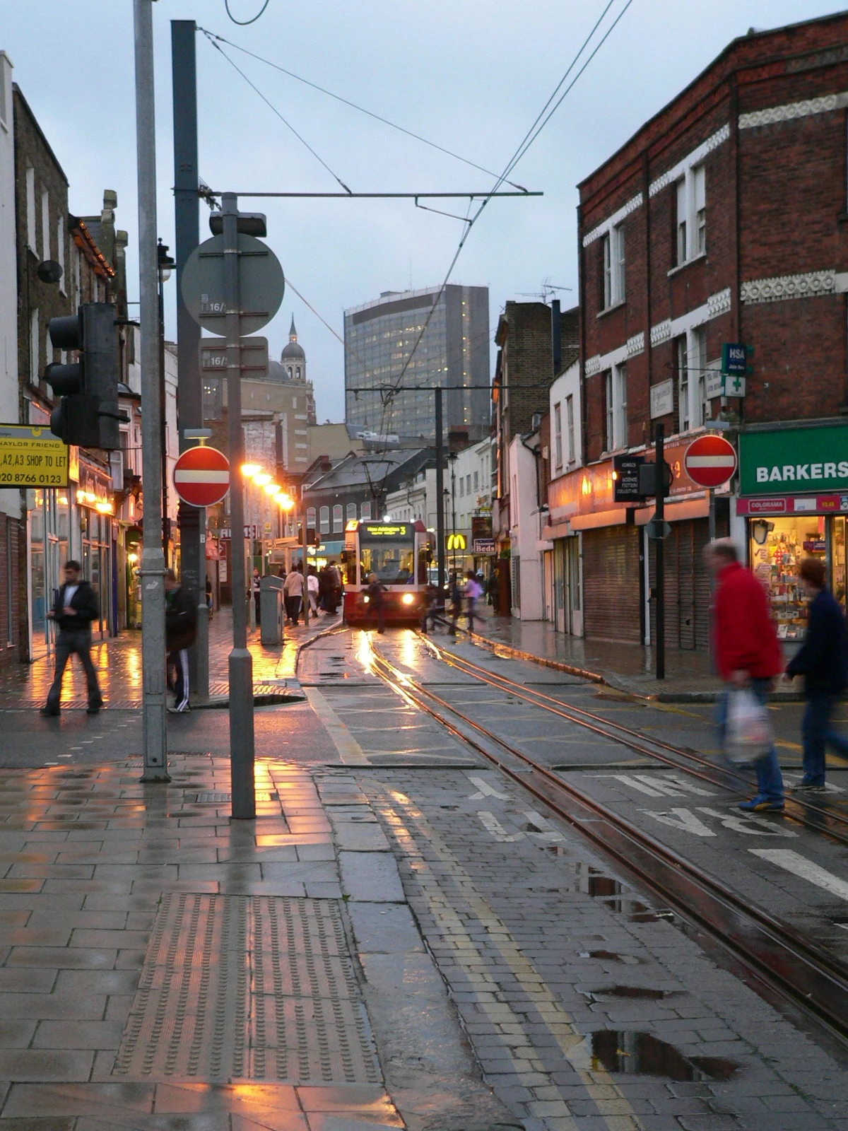

A tram travelling on Croydon high street
These are currently extremely busy bus corridors. Not surprisingly, the first generation trams were the mainstay on the Purley – Croydon – Streatham section and former tram routes 16 and 18, once amongst the most successful in London, continued to Brixton and central London. In this exercise, the corridor is to be reviewed as two separate extensions.
The proposal envisages Tramlink diverging from its central Croydon loop to pick up highway alignment probably using South End, and Brighton Road to Purley. Investigations will reveal whether the mass passenger movement achieved today by buses is more effectively catered for by a Tramlink extension. Beyond Purley, work will look at Coulsdon as a southern terminus within striking distance of the end of the M23. An important consideration here will be the possibility of a Park and Ride site that might funnel current car traffic into Croydon from the south onto public transport. Alignment difficulties will be more critical south of Purley, where Brighton Road carries the A23 trunk road traffic.
North of Croydon, London Road is again the obvious host for a Tramlink extension. South of Thornton Heath Pond, the shared carriageway is a possibility. North of this point, the road becomes the A23 again, but fortunately there are likely to be some opportunities for trambaan type segregation to Norbury and between Norbury and Streatham, although Norbury itself is a pinch point. Streatham Station will increase in importance as an interchange with the East London Line extension and this is envisaged as the northern terminus of the Tramlink extension. Whilst there is considerable merit in looking beyond Streatham, the challenge of the Streatham Library pinchpoint is perhaps one for a later date.
Other extensions[]
Work currently commissioned will also check out proposals to extend Tramlink to Biggin Hill, Bromley town centre, Lewisham, and Purley Way. If initial examination shows promise, further work could follow to firm up more detailed routings for these proposals.[7]
See also[]
- Transport in London (overview)
- Light Rail Transit Association
References[]
- ↑ Background of the Croydon Tramlink. Transport for London. Retrieved on 2007-11-16.
- ↑ TfL announces plans to take over Tramlink services. Transport for London. Retrieved on 2008-03-18.
- ↑ Map of current system using existing and former British rail lines. This is Local London. Retrieved on 2007-11-16.
- ↑ Crystal Palace extention options to reach the Parade PDF
- ↑ Consultation on hybrid scheme for Croydon Tramlink Transport for London
- ↑ Proposals to extend the Tramlink system Always Touch Out
- ↑ Template:Cite news
External links[]
- Transport for London Website on Tramlink
- Croydon Tramlink - The Unofficial Website
- Collection of Google Earth locations of Tramlink stops (Requires Google Earth software) from the Google Earth Community forum.
- Real-distance map
Template:Tramlink routes
UK light rail systems | ||||||||
|---|---|---|---|---|---|---|---|---|
| Tramways |
| |||||||
| Metro | ||||||||
| Preserved | ||||||||
Template:FirstGroup Template:Coor title d